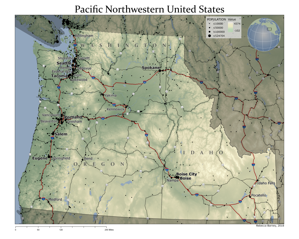
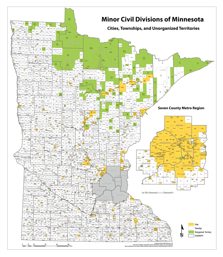
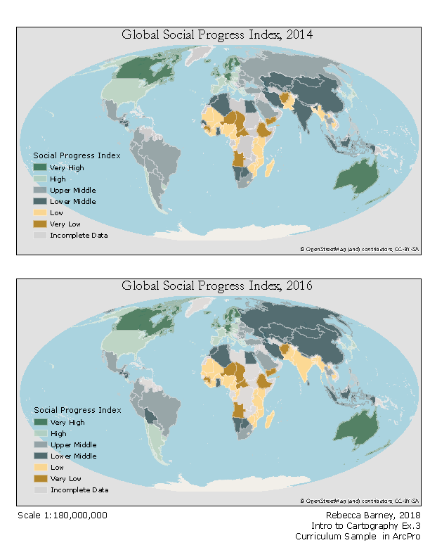
The Pacific Northwestern United States, 2018. TA Example Curriculum for Cartography GEOG 3511/5511. Made using ArcGIS Pro & Ken Field’s Terrain Toolbox.Cities, Townships and Counties of Minnesota, 2016. Group Coursework for GIS 5572. Made with ESRI’s ArcGIS Global Social Index Date Comparison, 2018. TA Example Curriculum for Cartography GEOG3511/5511. Made using ArcGIS Pro. Population Density in the Twin Cities Metro Region, 2018. TA Example Curriculum for Cartography GEOG 3511/5511. Made using ArcGIS Pro. New York Times Locator Map in black and white and in color, 2018. TA Example Curriculum for Cartography GEOG3511/5511. Made using ArcGIS Pro.Andros Island Generalization Exercise, 2015. Coursework for GIS 5571. Made with ESRI’s ArcGIS
Data Management Exercises
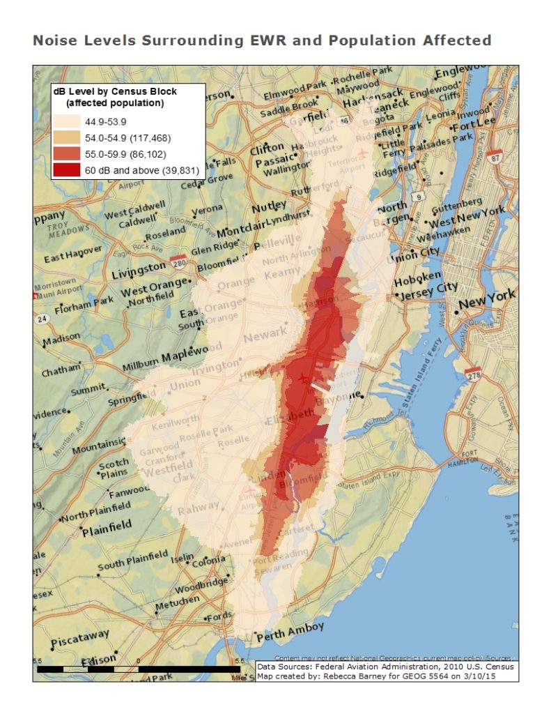
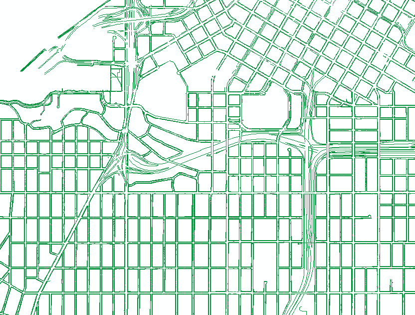
Airport Map Digitization Exercise, 2015. Coursework for GIS 5571. Made with ESRI’s ArcGISGunston Vectorization Exercise, 2015. Coursework for GIS 5571. Made with ESRI’s ArcGIS ArcScan Noise Levels Surrounding EWR and Population Affected, 2015. Coursework for Geog 5564. Made with ESRI’s ArcGIS
Pedestrian & Bicycle Cartography
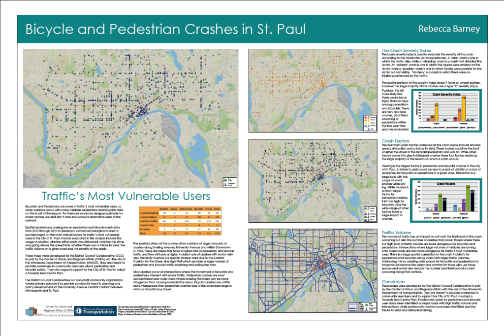
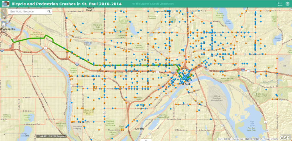
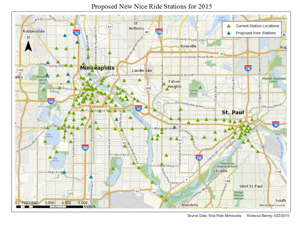
Bike and Pedestrian Crash Hot Spots in St. Paul 2010-2014. Project for Geog 5564. Made with ESRI’s ArcGISProposed New Nice Ride Stations for 2015, 2015. Coursework for PA 5235. Made with ESRI’s ArcGIS
Interactive Map Exercises
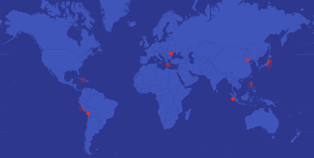
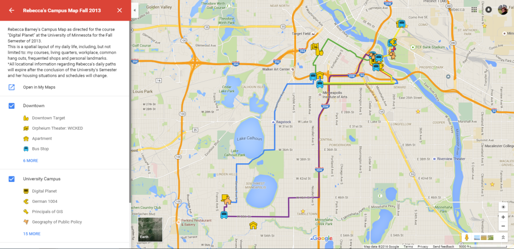
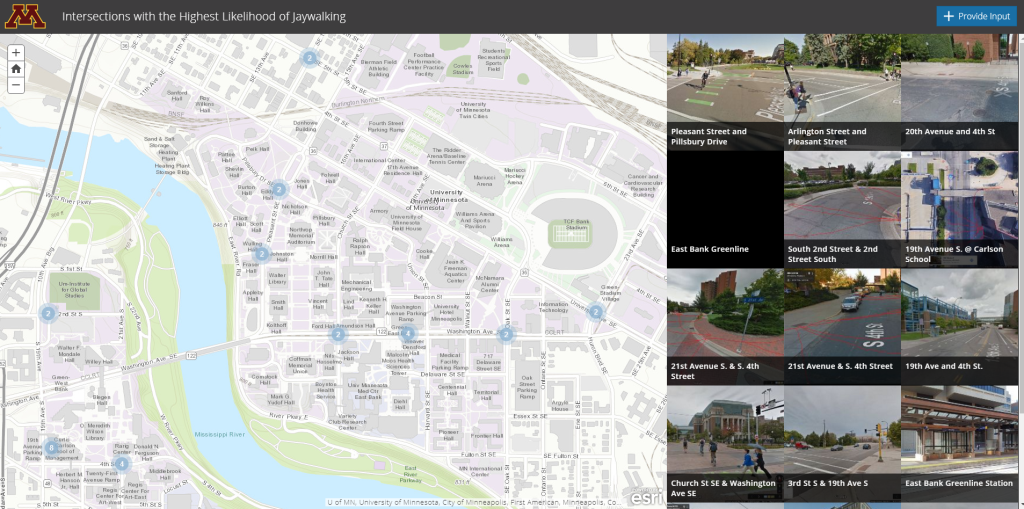
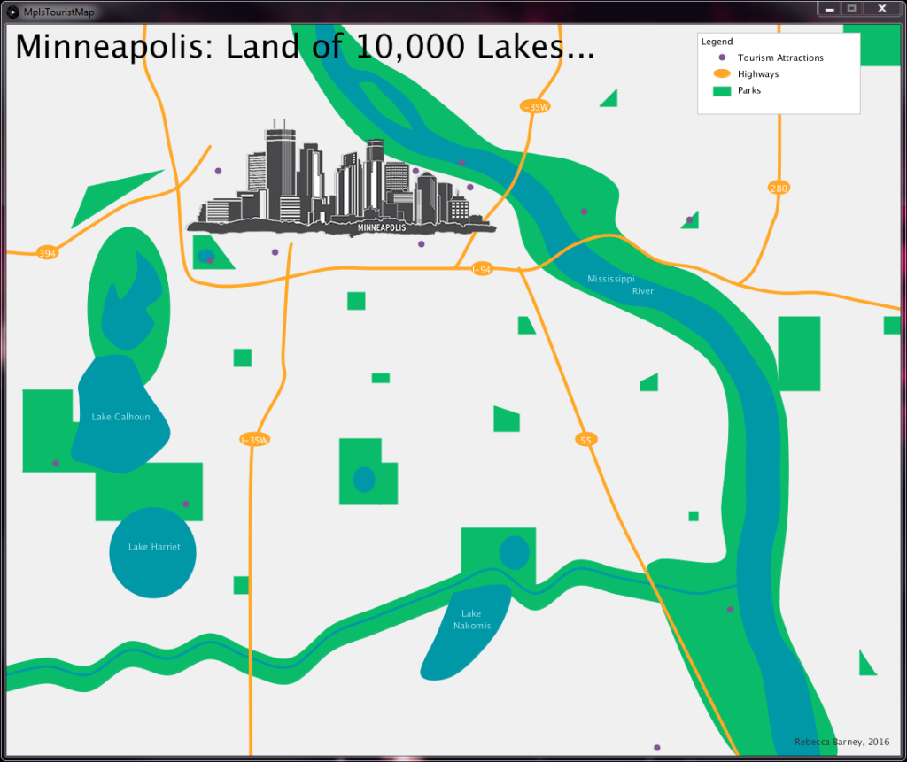
Time-Enabled Map of Earthquakes around the world, 2017. Coursework for GIS 5590. Made with CARTORebecca’ Campus Map, 2014. Coursework for Geog 3521. Made with Google Mapping Engine. For a link to the map, please click the icon to the right. Intersections with the Highest Likelihood of Jaywalking Crowd Source Map, 2017. Coursework for GIS 5590. Made with ESRI’s Crowdsource StorymapMinneapolis: Land of 10,000 Lakes Interactive Abstract Map, 2016. Coursework for GIS 5900. Interactive Map coded in Java using Processing. Portion of Rebecca’s Adventure Map, 2014. Project for Undergraduate Thesis. Made with Google Mapping Engine
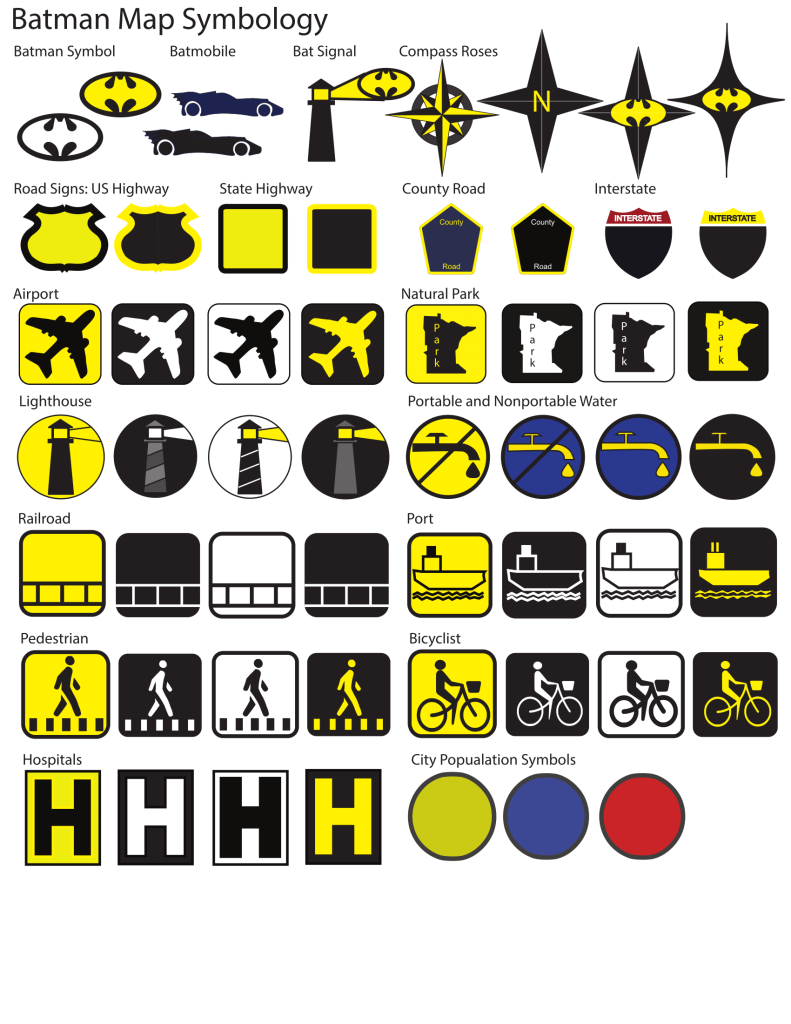
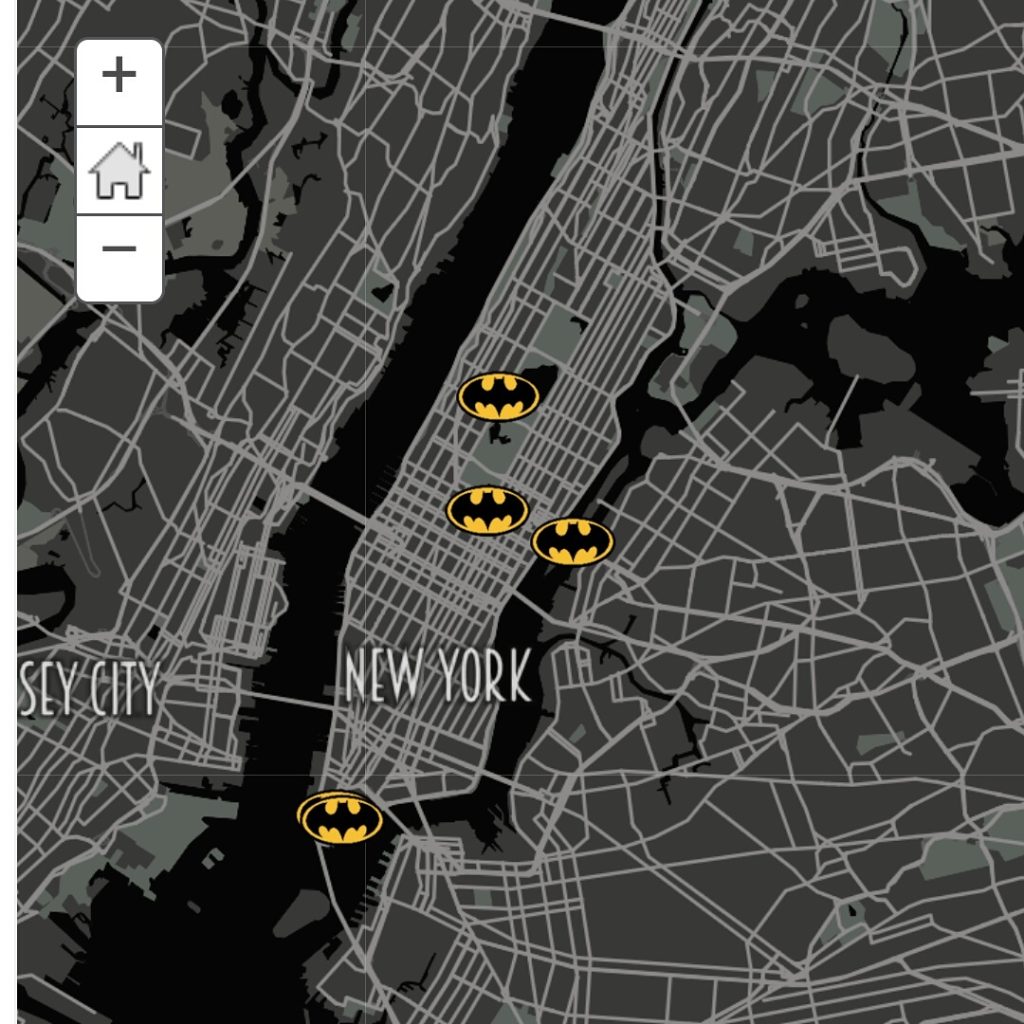
Batman Map Symbology, 2016. Group Coursework for GIS 5572. Made with Adobe IllustratorThe Batmap, 2016. Group Coursework for GIS 5574. Storymap created using Mapbox, ArcGIS Online, Storymaps, and personal research
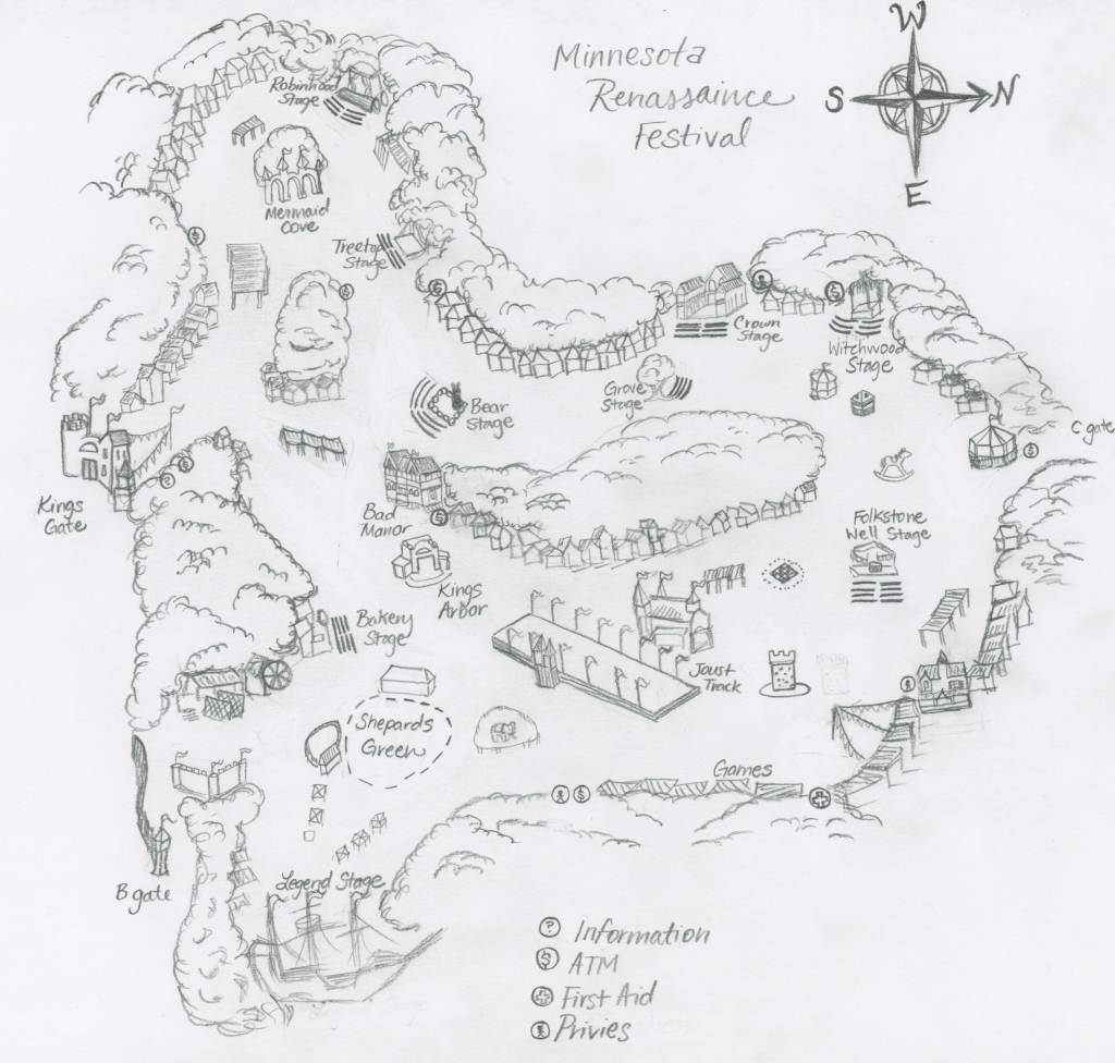
Hand Drawn Minnesota Renaissance Festival Map, 2016. Course work for GIS 5900. Paper and Pencil, Georeferenced in ArcGIS
3d Modeling & 3d Printing
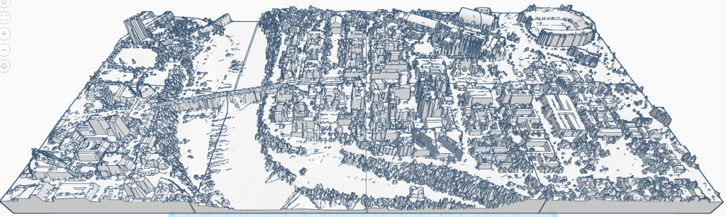
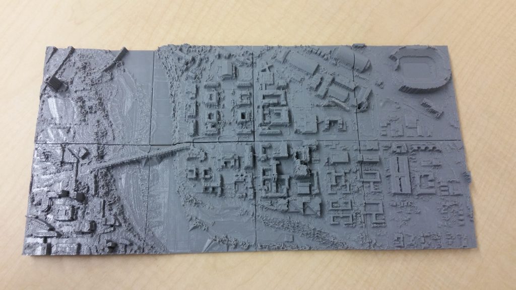
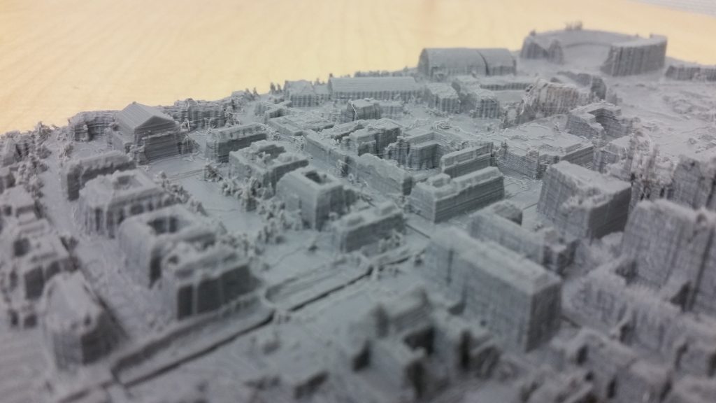
3D Printed Map of UMN Campus, 2017. Coursework for FNRM 5412. Made with LAStools, ArcGIS, 3DEM, Quick Terrain Modeler, QGIS, Blender & MakerBot Replicator+. Lidar Data from MnTopo.
3D Printed Map of UMN Campus, 2017. Coursework for FNRM 5412. Made with LAStools, ArcGIS, 3DEM, Quick Terrain Modeler, QGIS, Blender & MakerBot Replicator+. Lidar Data from MnTopo.
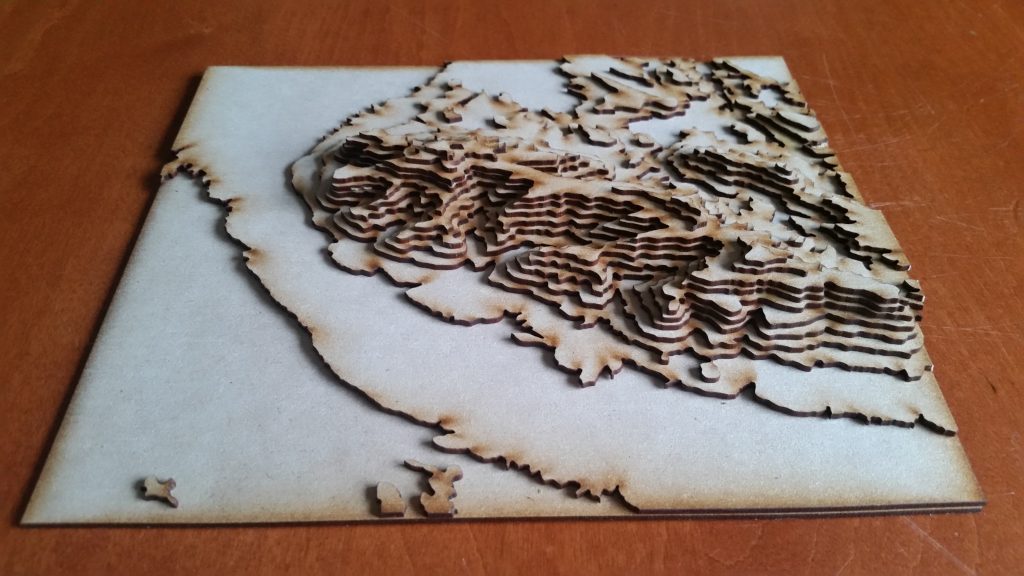
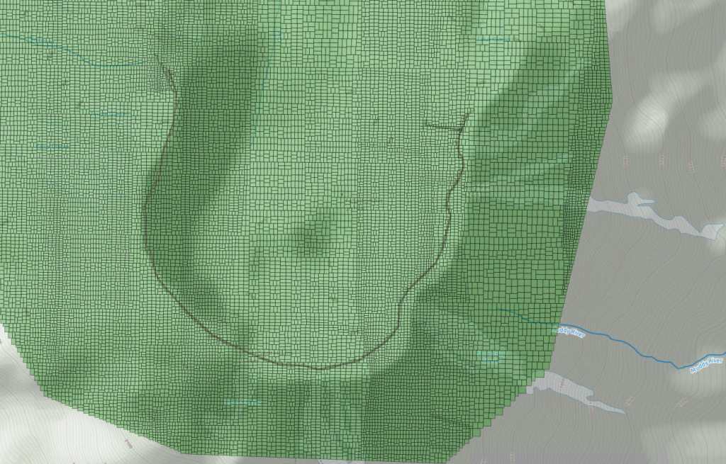
Superstition Mountains 3D Contour Map, 2017. Coursework for Arch3351. Made with QGIS, AutoCAD, Adobe Illustrator and Laser Cutter. Lidar Data of Mt. St. Helens, 2016. Coursework for GIS 5577. Made with Postgres, using SQL, visualized in QGIS
Database Management
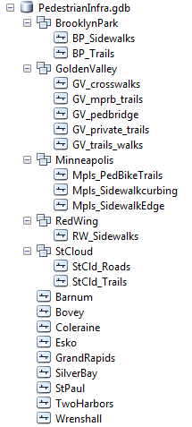
Pedestrian Infrastructure Database Clip, 2016. Project for PA 5232 and GIS 5577. Made with ESRI’s ArcGISSnapshot of Pedestrian Infrastructure Database, 2016. Project for GIS 5577. Made with ESRI’s ArcGIS
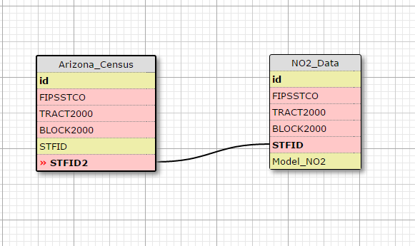
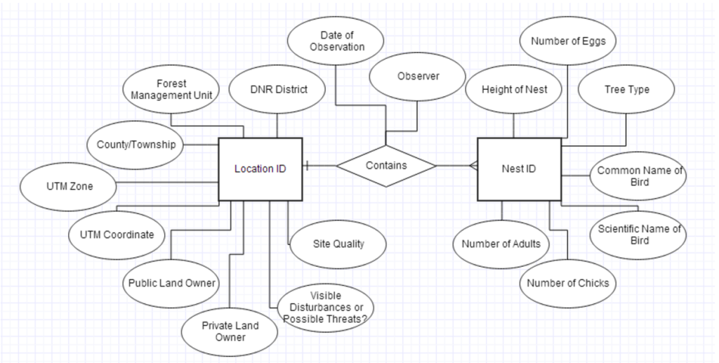
Simplified Conceptual Data Model, 2016. Coursework for GIS 5577. Made with WWW SQL Designer Conceptual Data Model of DNR’s Nest Records Form, 2014. Coursework for Geog5563. Made with Gliffy
Drone Experience
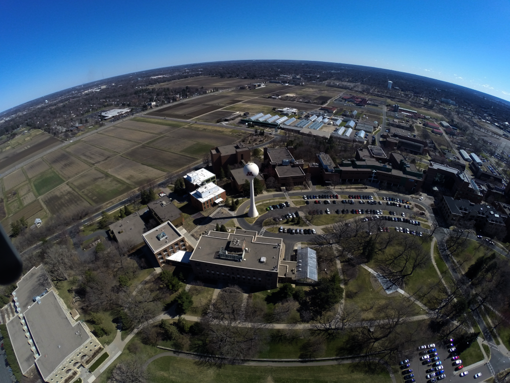
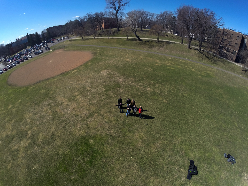
Drone Imagery, 2017. Coursework for FNRM 5412. Made with GoPro, 3DR Solo Drone & PhotoshopDronie (Selfie with a Drone), 2017. Coursework for FNRM 5412. Made with GoPro, 3DR Solo Drone & Photoshop