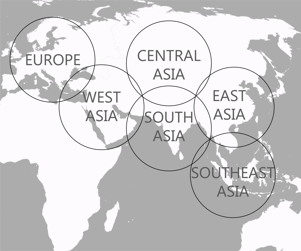
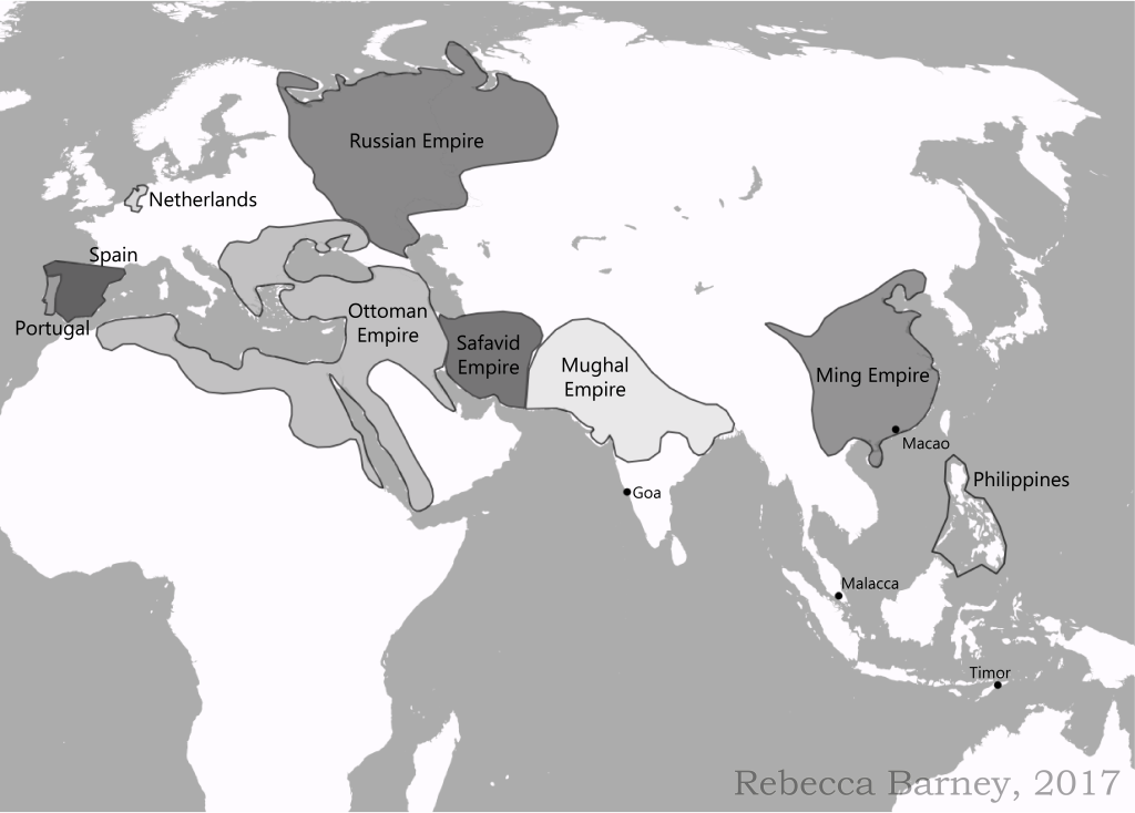
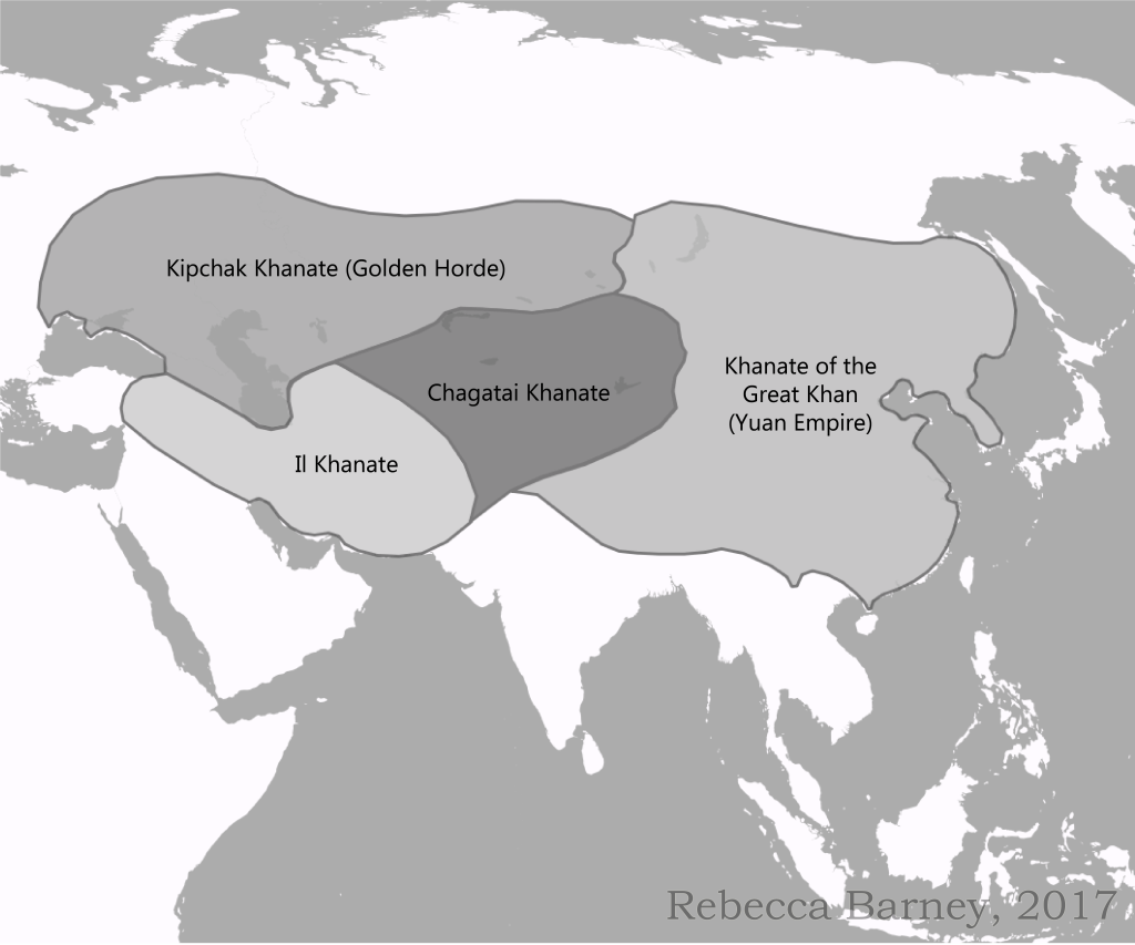
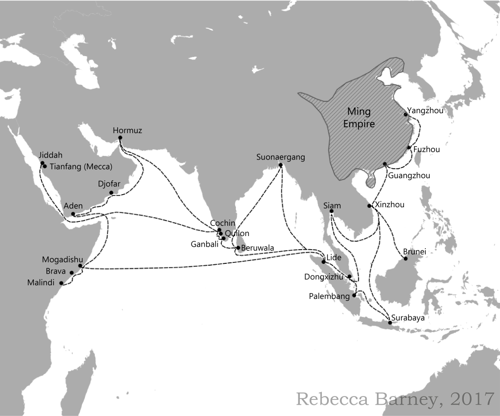
Map of Eurasia, 2017. Historical Map Collection Commission for a textbook. Made with QGIS.Historical Ming and other European Empires, 2017. Historical Map Collection Commission for a textbook. Made with QGIS. Historical Mongol Empires, 2017. Historical Map Collection Commission for a textbook. Made with QGIS.Zheng He’s Voyages, 2017. Historical Map Collection Commission for a textbook. Made with QGIS.
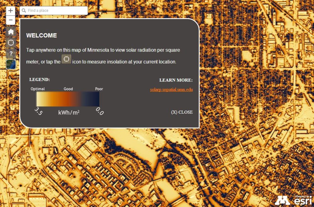
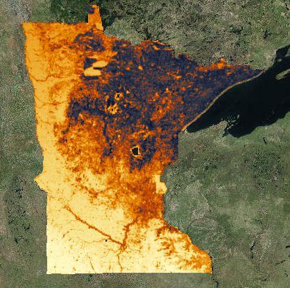
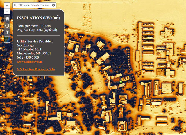
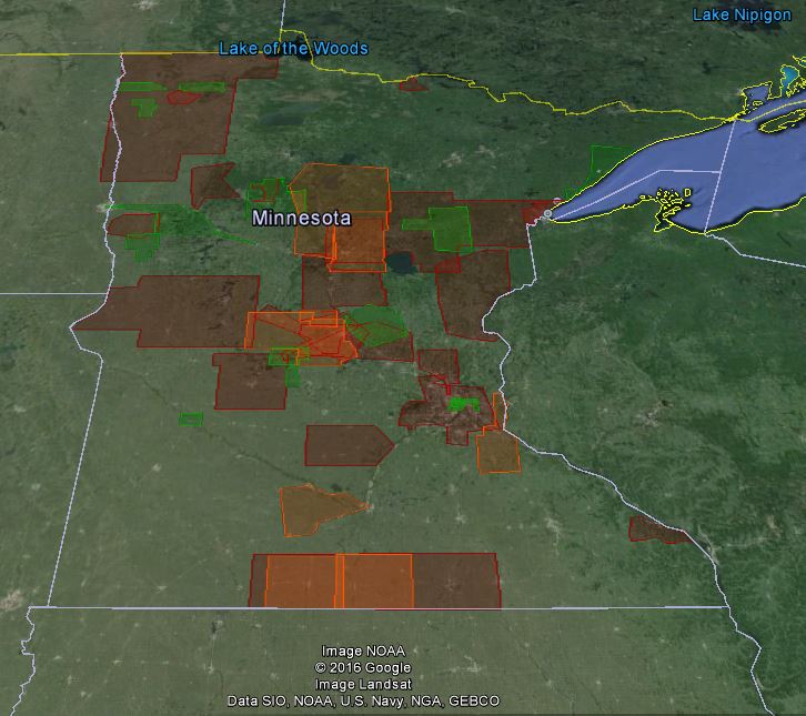
U-Spatial: Minnesota Solar Suitability Map
Ground-testing Evaluation Minnesota Solar Suitability Map, 2016. Made for U-Spatial. Evaluated using Microsoft ExcelGround-testing Evaluation Minnesota Solar Suitability Map, 2016. Made for U-Spatial. Evaluated using Microsoft ExcelGround-testing Evaluation Minnesota Solar Suitability Map, 2016. Made for U-Spatial. Evaluated using Microsoft Excel
U-Spatial: Courses Taught
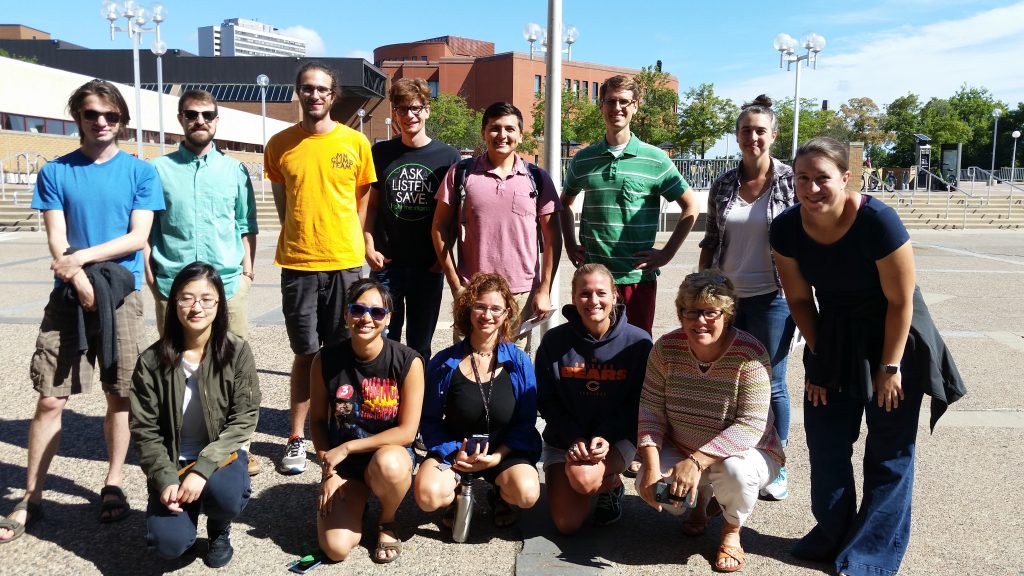
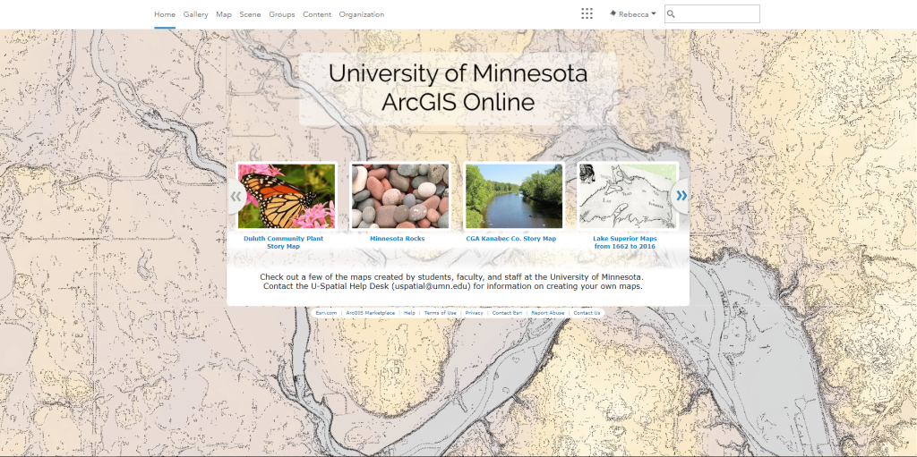
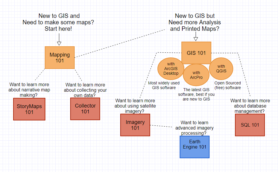
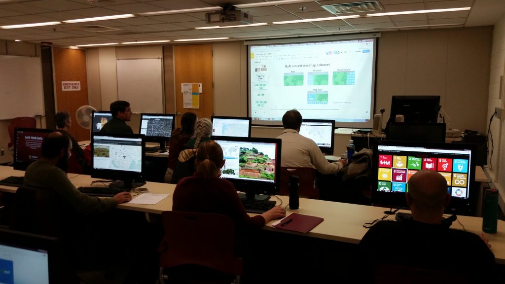
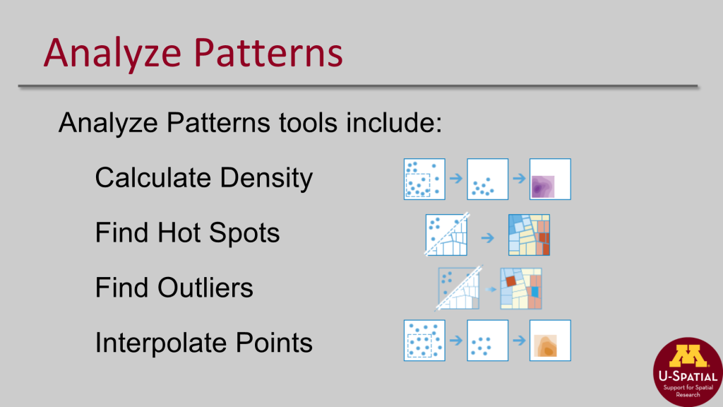
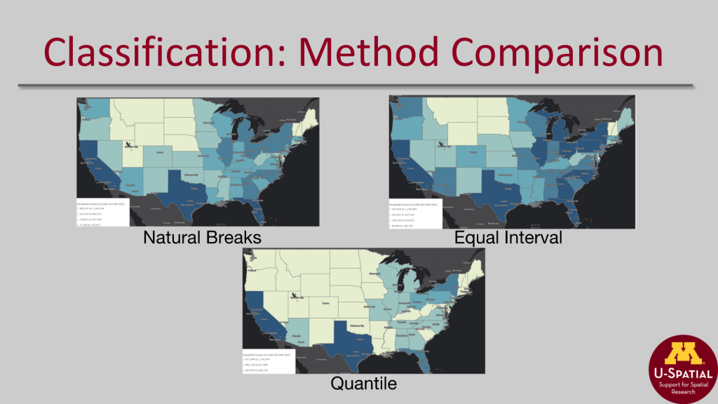
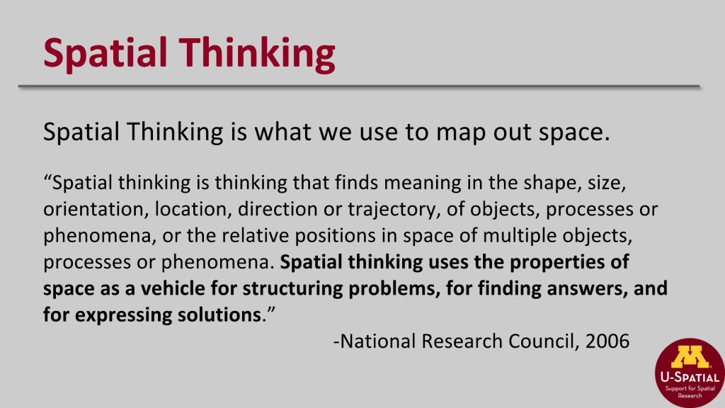
U-Spatial Summer Spatial Bootcamp Attendees, 2017. Coordinated and Organized the 2017 Spatial Summer Bootcamp an intensive week long training course offered by U-Spatial. University of Minnesota’s ArcGIS Online Homepage, 2017. Redesigned the University of Minnesota’s ArcOnline Homepage as part of ArcOnline Administration Duties in U-Spatial. Made with ArcPro and Adobe IllustratorU-Spatial Training Courses Offerings, Fall 2017. Offered Training Courses in the following topics for multiple workshop sessions. Training for U-Spatial. Made with GliffyU-Spatial Training Workshop Attendees, 2017. Updated, Developed and Taught U-Spatial’s Workshop Curriculum for Mapping 101, GIS 101, QGIS 101, Collector 101, Storymaps 101 and more. Mapping 101 Analyze Patterns Slide Mapping 101 Classification Methods Comparison Mapping 101 Spatial Thinking Slide
U-Spatial: Consulting Projects
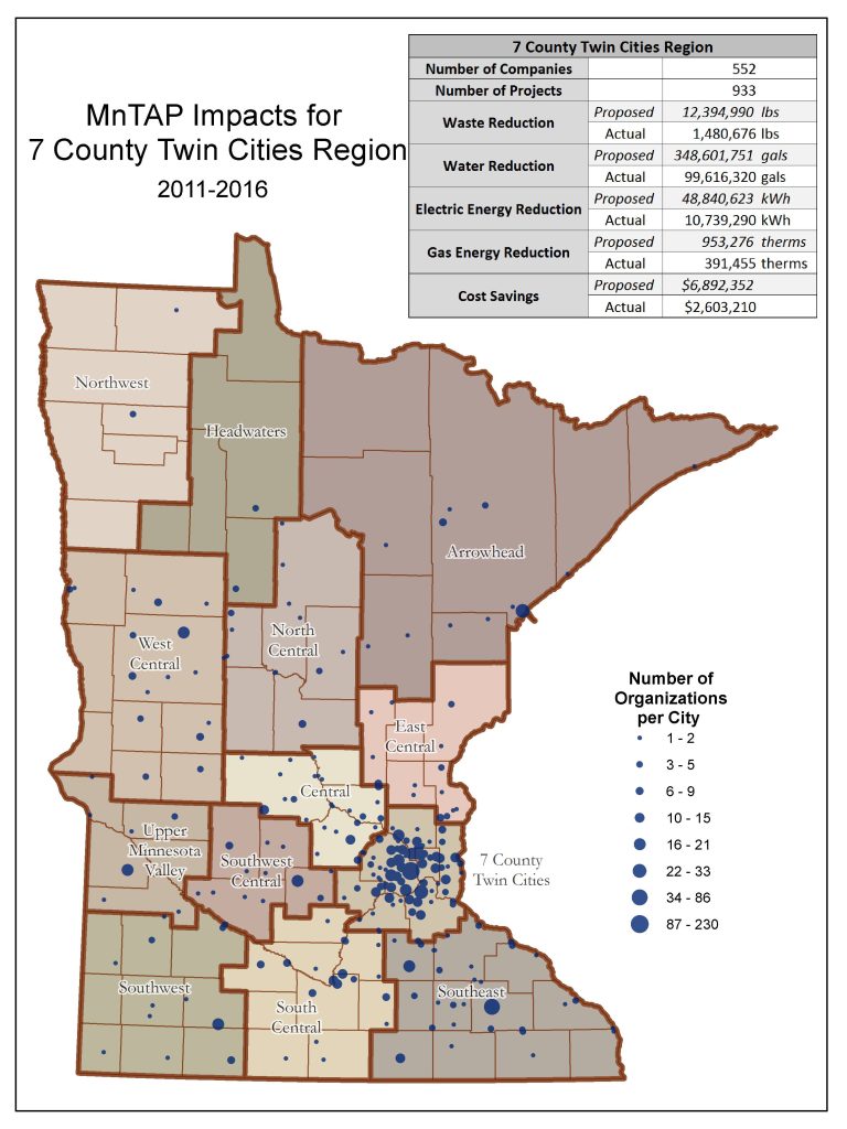
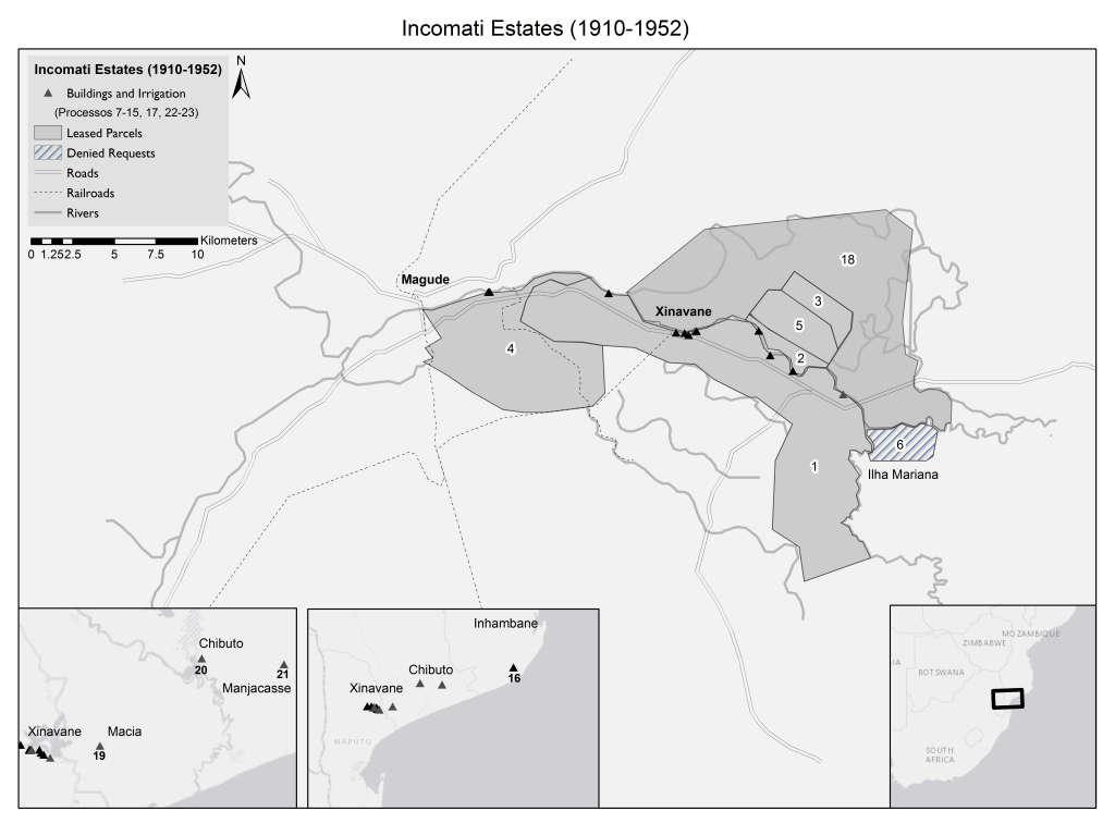
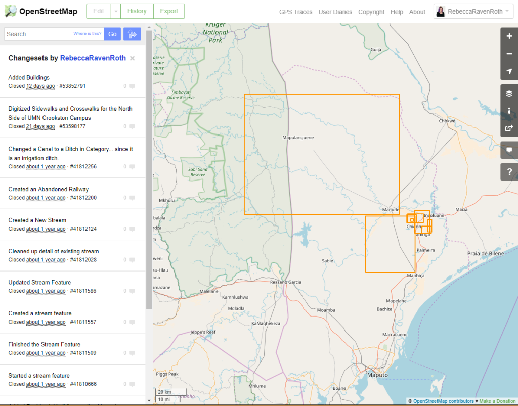
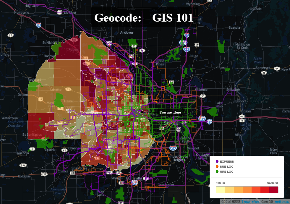
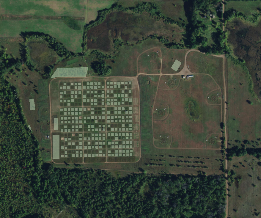
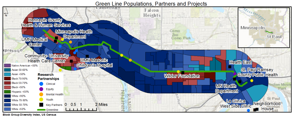
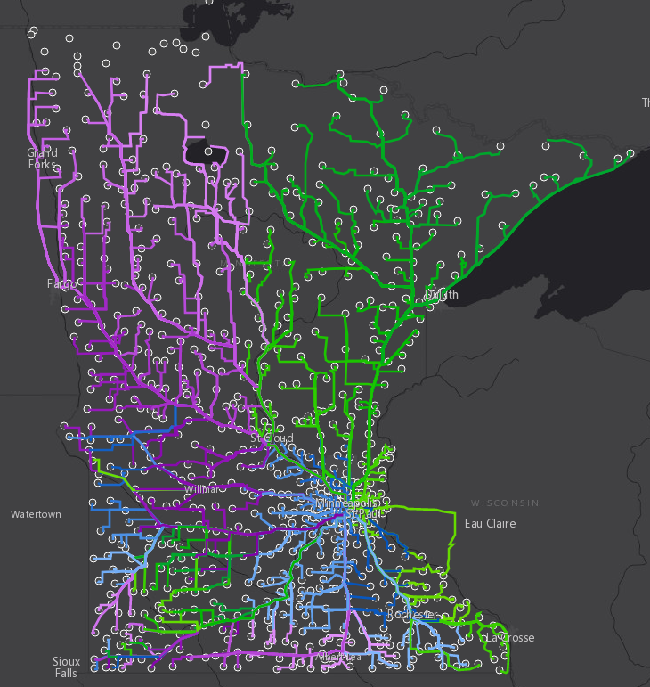
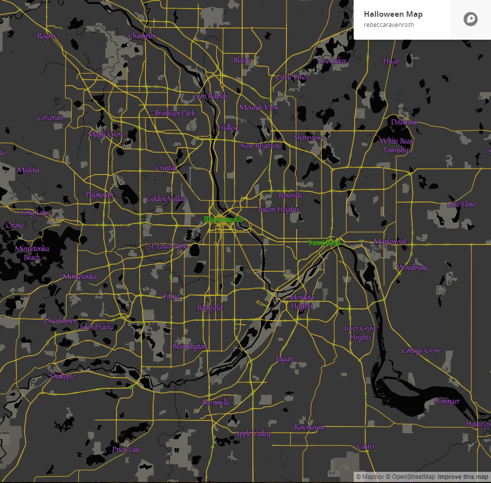
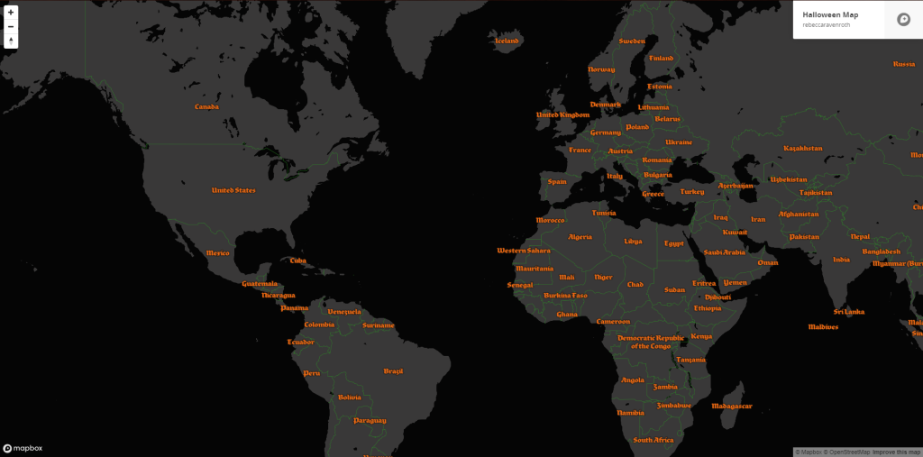
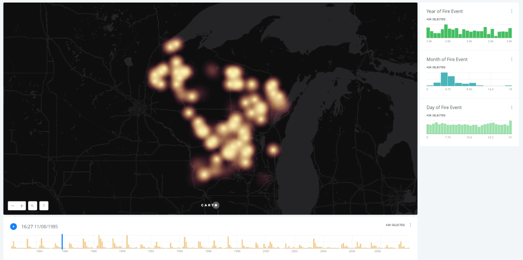
MnTAP Impact Maps, 2016. Made template for MnTAP to review annual impacts, trained MnTAP employees to update it each year. Task from U-Spatial Help Desk. Created with ArcGIS Desktop and Microsoft Excel.Maps for Xinavane Research, 2016. Made a series of maps for a PhD student’s research. Task from U-Spatial Help Desk. Created with ArcGIS Desktop. OpenStreetMap Edits, 2017. Work on updating the Open Street Map in order to help U-Spatial Help Desk Patrons find complete basemaps for their needs. Basemap from OpenStreetMap. Geocode 2.0: GIS 101 Workshop Example Map, 2015. Made for Geocode 2.0: GIS 101. Created with CARTO Cedar Creek Ecosystem Science Reserve Experiment Database, 2016. Helped design the basic structure for a database of the experiments at Cedar Creek for a project in U-Spatial. Created with ESRI’s ArcGISGreen Line Partners, 2016. Made mini-map for client’s grant application. Task from U-Spatial Help Desk. Created with ArcGIS Desktop. Origin Destination Networks in MN, 2017. Made a network analysis for every zipcode in MN to 5 major cites. Project for U-Spatial Help Desk. Made with ArcGIS Online Halloween Mapbox Basemap Style, 2017. Online Cartography Curriculum Development within Teaching Assistant Position. Made with Mapbox Halloween Mapbox Basemap Style, 2017. Online Cartography Curriculum Development within Teaching Assistant Position. Made with Mapbox Wildfires in Wisconsin Time-Enabled Map, 2017. Made example project for climate generation conference presentation. Presenter for U-Spatial. Made with CARTO
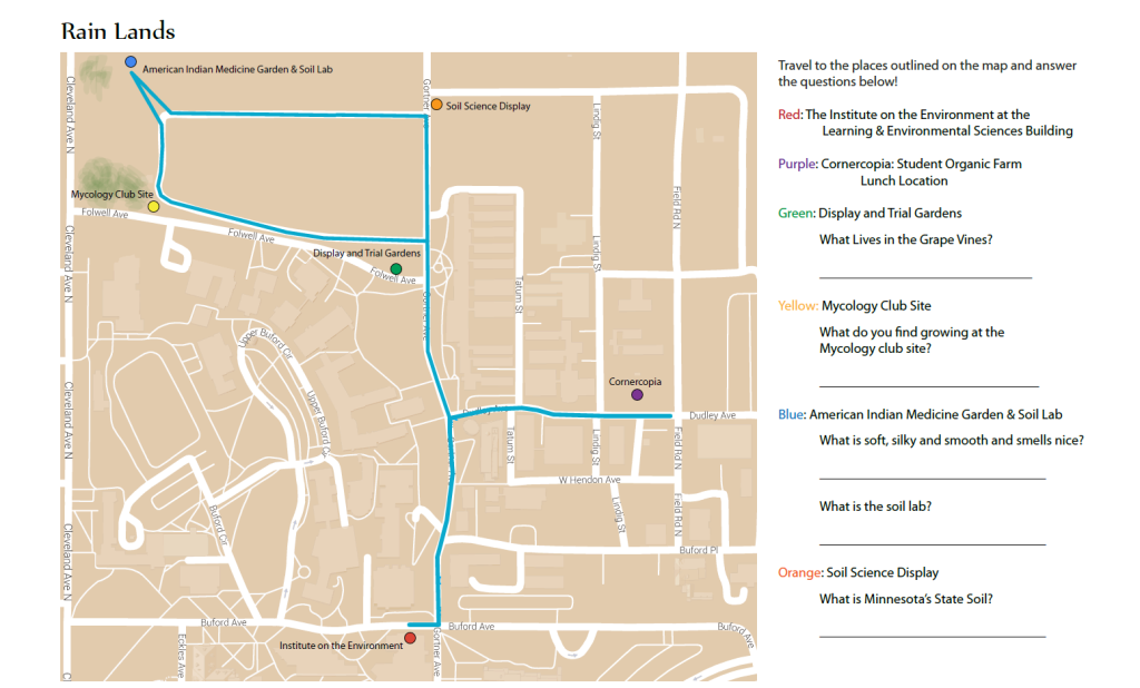
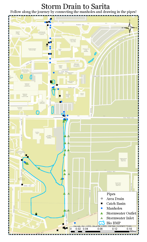
U-Spatial: Water Journeys
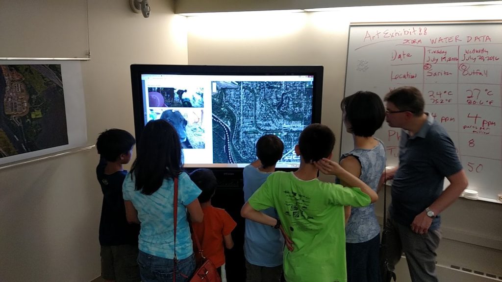
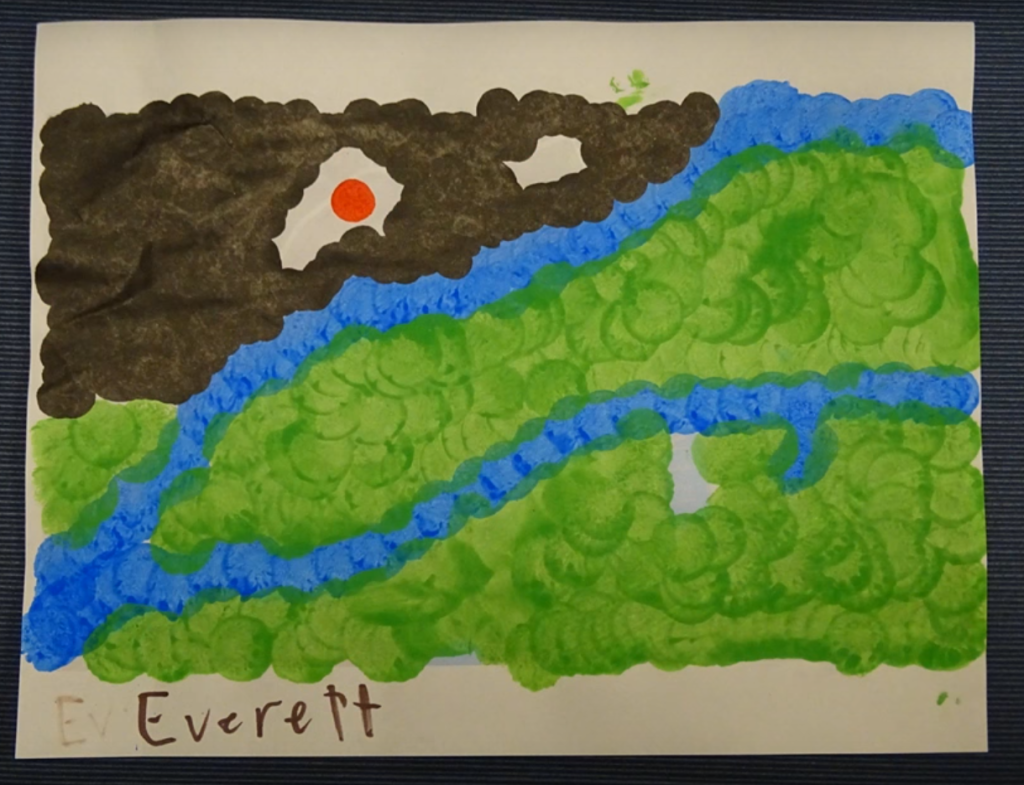
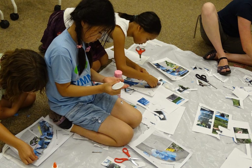
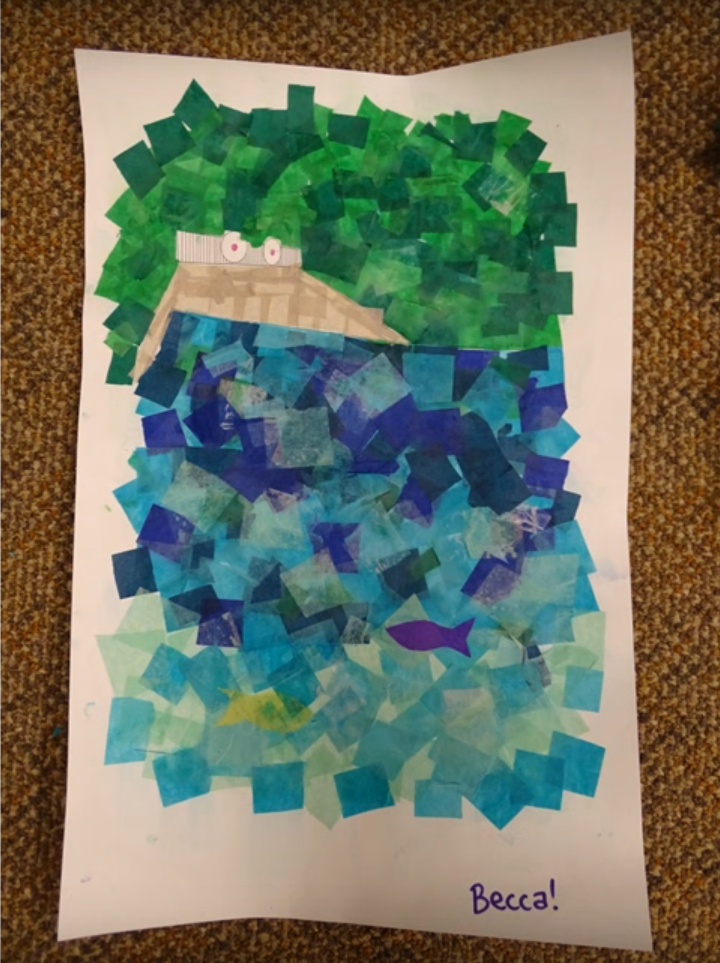
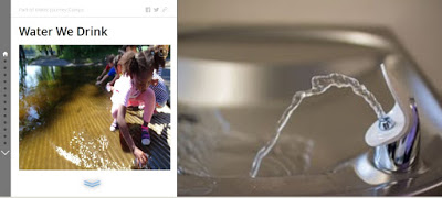
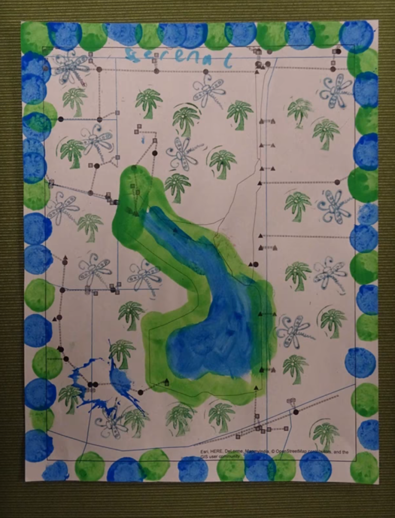
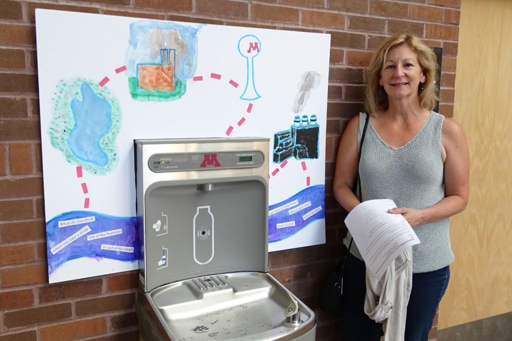
Water Journey Camps Map Art Curriculum Development, 2016. Helped develop curriculum for the U of M Summer Camps: Water Journeys. Used Storymaps to tell the tale of Storm water and Drinking Water. For more information follow the link to the blog documenting Water Journeys Water Journey Camps Map Art Curriculum Development, 2016. Helped develop curriculum for the U of M Summer Camps: Water Journeys. Used Storymaps to tell the tale of Storm water and Drinking Water. For more information follow the link to the blog documenting Water Journeys Mississippi River Park Collage Map, 2016. Developed an art project in which students made a map of the Mississippi River and River Park by collaging photos they took of the area and pasting them onto a basemap. Created with GoogleMaps and Adobe IllustratorWater Journey Camps Map Art Curriculum Development, 2016. Helped develop curriculum for the U of M Summer Camps: Water Journeys. Used Storymaps to tell the tale of Storm water and Drinking Water. For more information follow the link to the blog documenting Water JourneysWater Journey Camps Map Art Curriculum Development, 2016. Helped develop curriculum for the U of M Summer Camps: Water Journeys. Used Storymaps to tell the tale of Storm water and Drinking Water. For more information follow the link to the blog documenting Water Journeys Greening up the Infrastructure of Sarita Map, 2016. Made a map of the infrastructure surrounding Sarita Wetland and had the students “fill in” the map with the vegetation and water that existed there. Made with ESRI’s ArcGIS and FingerpaintWater Journey Camps Map Art Curriculum Development, 2016. Helped develop curriculum for the U of M Summer Camps: Water Journeys. Used Storymaps to tell the tale of Storm water and Drinking Water. For more information follow the link to the blog documenting Water Journeys Water Journeys Storm Drain to Sarita Map, 2016. Designed an interactive connect-the-dots map outlining storm drains for students to “draw in” the pipes. Created with ESRI’s ArcGIS Water Journeys Storm Drain to Sarita Map, 2016. Designed an interactive connect-the-dots map outlining storm drains for students to “draw in” the pipes. Created with ESRI’s ArcGIS Water Journeys Storm Drain to Sarita Map, 2016. Designed an interactive connect-the-dots map outlining storm drains for students to “draw in” the pipes. Created with ESRI’s ArcGIS
Curriculum Development: QGIS
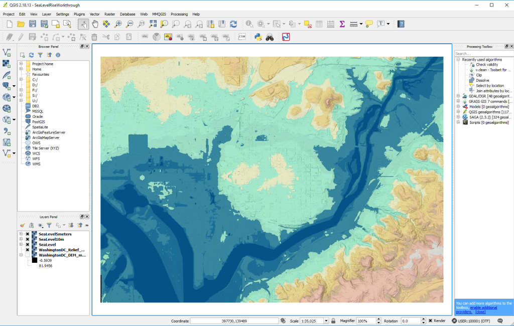
Utah Interpolation QGIS curriculum development Lab 6: Sea Level Rise and Uncertainty Workthrough, 2016. QGIS Curriculum Development for Advanced GIS Labs following Teaching Assistant Position. Made with QGIS
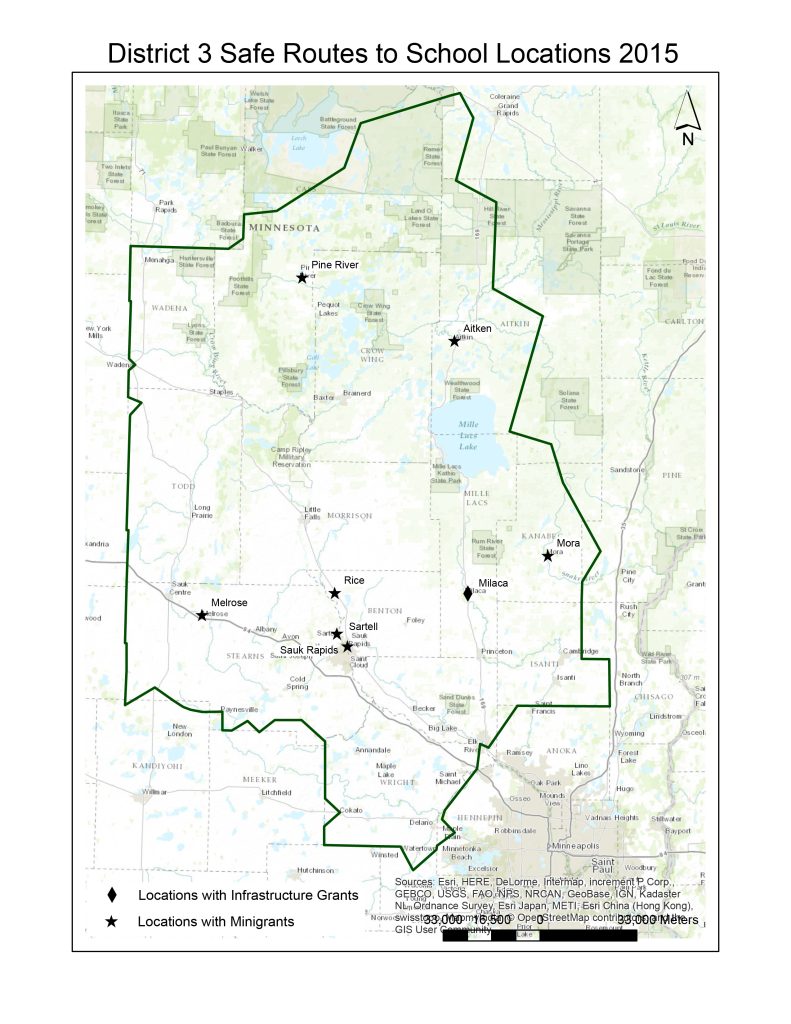
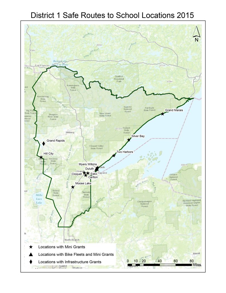
MnDOT: Safe Routes to School
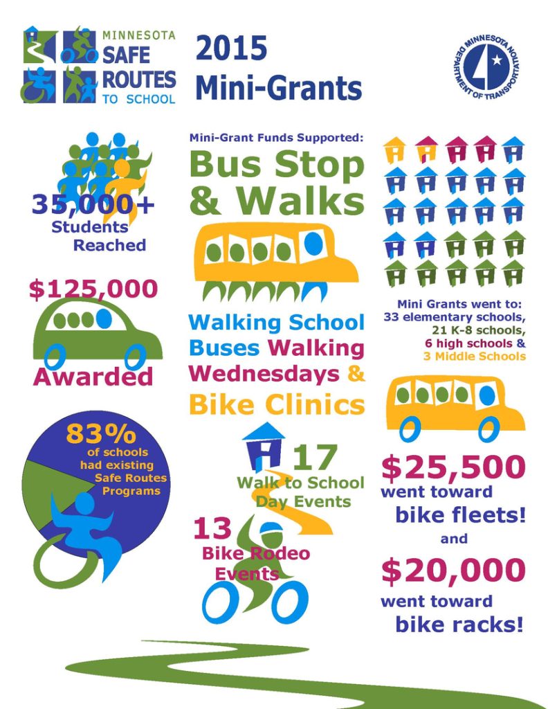
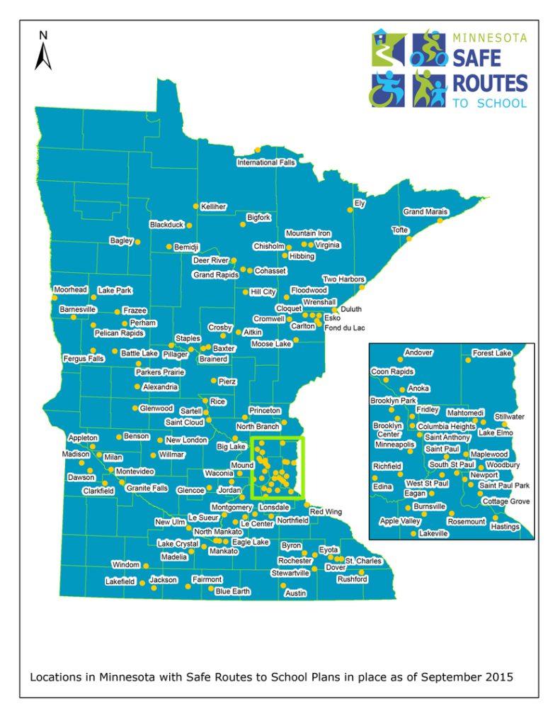
Legislative Report Maps (2 of 7), 2015. Made for MnDOT. Created with ESRI’s ArcGIS Legislative Report Maps (1 of 7), 2015. Made for MnDOT. Created with ESRI’s ArcGISSafe Routes to School Mini Grants Infographic, 2015. Made for MnDOT. Created with Adobe Illustrator Safe Routes to School Minnesota Planning Map, 2015. Made for MnDOT. Created with ESRI’s ArcGIS
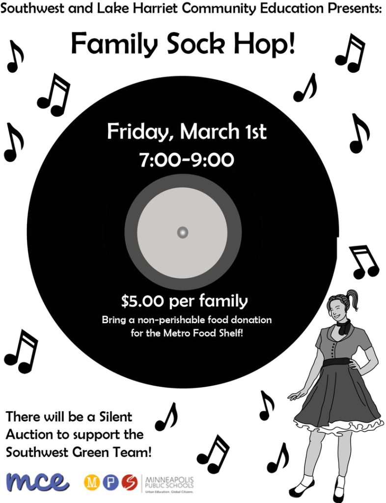
Swced: Flyer Designs
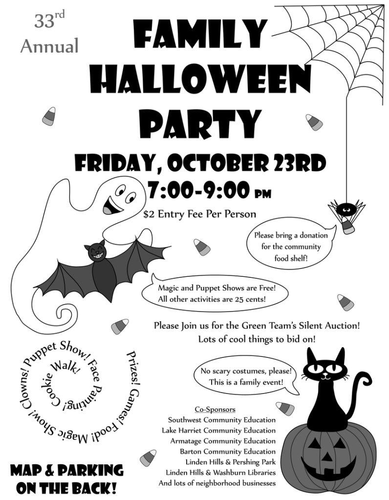
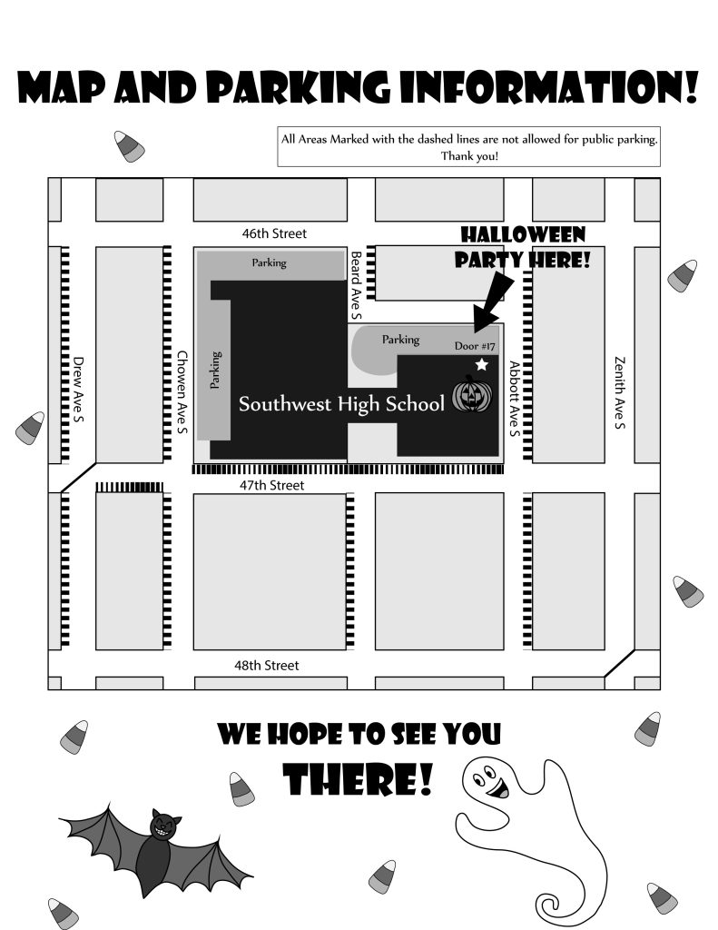
Halloween Party Flyer, 2012. Made for Southwest Community Education. Created with Adobe Illustrator Halloween Party Flyer Map, 2012. Made for Southwest Community Education. Created with Adobe Illustrator Sock Hop Flyer, 2012. Made for Southwest Community Education. Created with Adobe Illustrator
Undergraduate Research: Transit Service
Alternative Transit Service Providers Map, 2013. Made for Professor Francis Harvey and MnDOT. Created with GoogleEarth in KML.